Indonesia’s burned area 38pc higher than 2019 as hotspots continue to rise印尼过火面积比2019年增加38%,热点地区持续上升
JAKARTA, Oct 19 — Fires in Indonesia burned through more than 1.9 million hectares between January and the end of September this year, a monitor analysing satellite imagery...
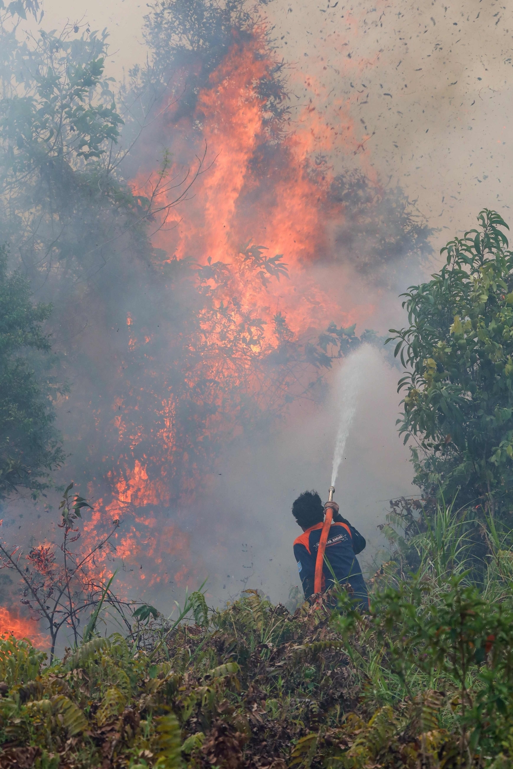
Between January and September 2023, fires in Indonesia have burned over 1.9 million hectares, according to satellite data from Nusantara Atlas, a deforestation monitoring site.
This conservative estimate, challenged by the presence of haze, is believed to be an underrepresentation of the true extent, as stated by founder David Gaveau.
Despite lacking official government figures post-July, preliminary data indicates a 38% increase in burned areas compared to 2019, and the situation may be akin to the severe fires in 2015.
JAKARTA, Oct 19 — Fires in Indonesia burned through more than 1.9 million hectares between January and the end of September this year, a monitor analysing satellite imagery said today.
The figure, covering an area nearly 12 times larger than London, is a conservative estimate partly because haze has complicated satellite verification, said David Gaveau, founder of deforestation monitoring site Nusantara Atlas.
Indonesia’s government has not provided official figures for areas burned since announcing that 202,000 hectares had been razed by the end of July.
Gaveau said the true scale of the burning was likely to be even higher than the 1,916,588 hectares his organisation had detected so far.
“Our burned-area estimates are conservative for two reasons. First, we exclude individual burn scars smaller than 6.25 hectares... Second, we prioritise avoiding false detections,” he said.
This year, the calculations have also been affected by heavy haze, which has obscured satellite images at times.
“The total reported burned area therefore underestimates the true area burned,” he said.
Even so, Nusantara Atlas data shows that the area burned by the end of September this year was 38 per cent higher than at the same point in 2019.
The satellites used by the monitor were not available during the severe fires in 2015, so comparable data is unavailable.
But Gaveau said this year was likely to be similarly bad.
“My intuition is that it probably is as bad. If you look at the sheer number of hotspots, it’s still trending up and up,” he said. — AFP
Lula or Bolsonaro’s son? Brazil braces for final choice in knife‑edge runoff
Kenya starvation cult pastor found guilty of murdering 190 children in Shakahola massacre
Myanmar releases new Suu Kyi photos as King Charles sends package to ‘special prisoner’
Malaysia haze: 30 areas record unhealthy API readings as of 9am; Batu Muda in KL and Johan Setia in Selangor highest
RoS deregisters Perikatan after coalition fails to refute grounds for cancellation
Budget 2027: Gig workers welcome aid to ease costs, boost earnings
根据森林砍伐监测网站 Nusantara Atlas 的卫星数据显示,2023 年 1 月至 9 月期间,印度尼西亚的火灾烧毁了超过 190 万公顷的土地。
创始人戴维·加沃表示,这种保守的估计,由于雾霾的存在而受到挑战,被认为低估了真实程度。
尽管7月之后缺乏官方政府数据,但初步数据显示,与2019年相比,烧毁面积增加了38%,情况可能类似于2015年的严重火灾。
雅加达,10 月 19 日——一个分析卫星图像的监测机构今天表示,今年 1 月至 9 月底,印度尼西亚的火灾烧毁了超过 190 万公顷的土地。
森林砍伐监测网站 Nusantara Atlas 的创始人 David Gaveau 表示,该数字所覆盖的面积几乎是伦敦的 12 倍,这只是一个保守估计,部分原因是雾霾使卫星验证变得复杂。
自7月底宣布已有20.2万公顷土地被烧毁以来,印尼政府尚未提供官方的过火面积数据。
加沃表示,实际燃烧的面积可能比他的组织迄今为止发现的 1,916,588 公顷还要大。
他说:“我们对过火面积的估计比较保守,原因有二。首先,我们排除了面积小于6.25公顷的单个过火区域……其次,我们优先避免误报。”
今年,严重的雾霾也影响了计算结果,雾霾有时会遮蔽卫星图像。
“因此,已报告的过火面积总和低估了实际过火面积,”他说。
即便如此,努沙登加拉地图集的数据显示,截至今年 9 月底,过火面积比 2019 年同期高出 38%。
2015 年发生严重火灾时,监测所用的卫星无法使用,因此无法获得可比数据。
但加沃表示,今年的情况可能也同样糟糕。
“我的直觉是情况可能更糟。看看疫情热点的数量,就知道还在不断上升,”他说。——法新社
卢拉还是博索纳罗之子?巴西严阵以待,迎接势均力敌的决选。
肯尼亚饥饿邪教牧师被判犯有在沙卡霍拉大屠杀中谋杀190名儿童的罪行
缅甸公布昂山素季新照片,与此同时,查尔斯国王向“特殊囚犯”寄送包裹
马来西亚雾霾:截至上午9点,30个地区API读数不健康;吉隆坡的 Batu Muda 和雪兰莪的 Johan Setia 最高
在联盟未能反驳取消注册的理由后,新加坡社团注册局(RoS)注销了国民联盟(Perikatan)的注册资格。
2027年预算案:零工经济从业者欢迎援助以降低成本、提高收入