MetMalaysia issues thunderstorm warning for northern states, Sabah and Sarawak until noon马来西亚气象局对北部各州、沙巴和砂拉越发布雷暴警告,持续至中午。
KUALA LUMPUR, Sept 18 — The Malaysian Meteorological Department (MetMalaysia) has issued a thunderstorm warning covering multiple states across the country, cautioning that...
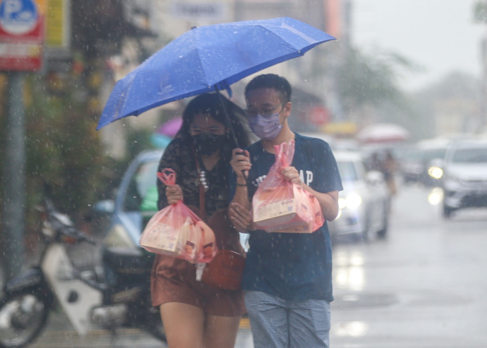
The Malaysian Meteorological Department has issued a thunderstorm warning affecting multiple states, including Perlis, Kedah, Penang, Perak, Melaka, and parts of Johor in Peninsular Malaysia, as well as specific regions in Sarawak and Sabah in East Malaysia.
The advisory alerts residents of potential thunderstorms, heavy rain, and strong winds expected until noon.
The warning, valid for up to six hours per issuance, advises caution due to risks of flash floods and reduced visibility.
KUALA LUMPUR, Sept 18 — The Malaysian Meteorological Department (MetMalaysia) has issued a thunderstorm warning covering multiple states across the country, cautioning that thunderstorms, heavy rain and strong winds are expected until 12 noon today.
In the northern peninsula, the entire state of Perlis is under warning, along with several districts in Kedah, including Bandar Baharu, Kulim, Pendang, Pokok Sena, Langkawi, Kubang Pasu, Kota Setar, Kuala Muda, Yan and Baling.
Penang is also affected in its entirety, while Perak faces widespread impact across Hulu Perak, Kerian, Selama, Larut Matang, Manjung, Bagan Datuk, Hilir Perak, Perak Tengah and Kuala Kangsar.
Further south, the whole of Melaka has been placed under the warning, alongside three districts in Johor — Muar, Tangkak and Batu Pahat.
In East Malaysia, Sarawak's Miri division is expected to see stormy conditions across Marudi, Beluru, Miri and Subis, with Limbang also included.
Sabah faces the broadest exposure in the region, with the Interior areas of Kuala Penyu, Beaufort, Membakut and Sipitang under warning, as well as the West Coast districts of Papar, Kota Belud, Tuaran, Kota Kinabalu, Putatan and Penampang. W.P. Labuan rounds out the list of affected areas.
MetMalaysia explained that a thunderstorm warning is triggered when signs point to storms bringing rainfall exceeding 20mm per hour, either imminent or expected to persist for more than an hour.
Such warnings are valid for no longer than six hours per issuance.
Residents and motorists in the affected areas have been urged to exercise caution, particularly given the risk of flash floods and reduced visibility associated with heavy downpours and strong winds.
Weak 3.7-magnitude earthquake strikes off Sandakan, no tsunami threat to Malaysia
Passenger dies after medical emergency on Malaysia Airlines flight to Sydney
Negeri Sembilan State Secretary’s Office backs AGC view, says won’t gazette April 19 proclamation on Ruler
马来西亚气象局已发布雷暴警告,影响马来西亚半岛多个州属,包括玻璃市、吉打、槟城、霹雳、马六甲和柔佛部分地区,以及东马的沙捞越和沙巴特定地区。
该预警提醒居民,预计中午之前可能会出现雷暴、暴雨和大风天气。
该警告每次发布有效期最长为六小时,提醒人们注意防范突发洪水和能见度降低的风险。
吉隆坡,9月18日讯——马来西亚气象局(MetMalaysia)发布雷暴警告,覆盖全国多个州属,预计雷暴、暴雨和大风天气将持续到今天中午12点。
在北部半岛,整个玻璃市州以及吉打州的几个地区都处于警告状态,包括班达尔巴哈鲁(Bandar Baharu)、居林(Kulim)、彭当(Pendang)、博科塞纳(Pokok Sena)、兰卡威(Langkawi)、古邦巴苏(Kubang Pasu)、哥打士打(Kota Setar)、瓜拉慕达(Kuala Muda)、延(Yan)和华玲(Baling)。
槟城也受到了整体影响,而霹雳州则面临着广泛的影响,包括乌鲁霹雳州、吉里安、塞拉玛、拉律马登、曼绒、巴眼拿督、霹雳州希里尔、霹雳登雅和瓜拉江沙。
再往南,整个马六甲州以及柔佛州的三个地区——麻坡、东甲和峇株巴辖——都已被列入警告范围。
在东马,预计砂拉越州美里省的马鲁迪、贝鲁鲁、美里和苏比斯等地将出现暴风雨天气,林梦地区也将受到影响。
沙巴面临着该地区最广泛的风险,瓜拉班尤、博福特、曼巴库和实必登的内陆地区以及西海岸地区的巴帕、哥打毛律、斗亚兰、亚庇、布达丹和兵南邦受到警告。 WP Labuan 是受影响地区的最后一个。
马来西亚气象局解释说,当迹象表明暴风雨即将到来或预计持续超过一小时,且降雨量超过每小时 20 毫米时,就会触发雷暴警告。
此类警告的有效期每次发出不超过六小时。
受影响地区的居民和驾车人士已被敦促谨慎行事,尤其要考虑到暴雨和大风可能引发山洪暴发和能见度降低的风险。
马来西亚山打根附近海域发生3.7级弱地震,无海啸威胁。
马来西亚航空公司飞往悉尼的航班上,一名乘客因突发疾病死亡
森美兰州秘书长办公室支持总检察署的观点,表示不会在4月19日公布关于统治者的公告。