Tampines is Singapore’s most populous planning area, but Punggol and Sengkang are growing faster淡滨尼是新加坡人口最密集的规划区,但榜鹅和盛港的增长速度更快。
They are among Singapore's 55 planning areas. Read more at straitstimes.com.
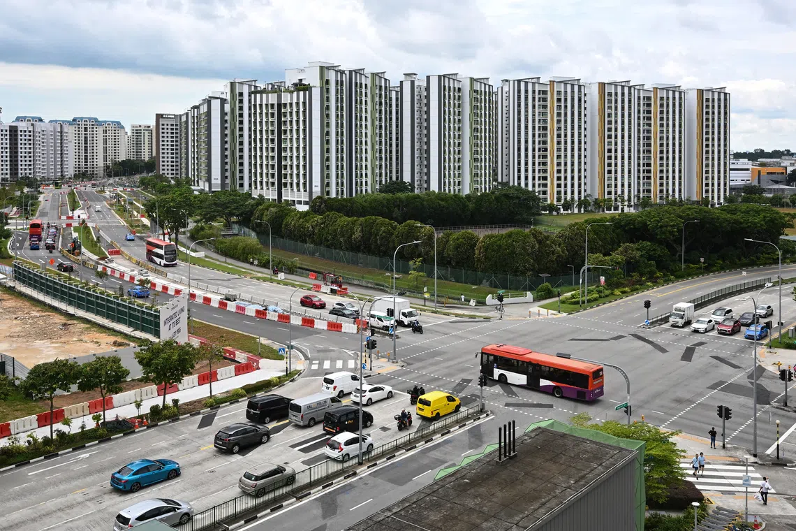
As at June 2026, the Tampines planning area has 296,060 Singapore residents, which includes citizens and permanent residents.
ST PHOTO: LIM YAOHUI
Published Oct 28, 2026, 03:00 PM
Updated Oct 28, 2026, 03:00 PM
SINGAPORE – Tampines is Singapore’s most populous planning area for the third consecutive year , but the north-east towns of Sengkang and Punggol are growing faster.
Tampines had 296,060 citizens and permanent residents in June 2026, ahead of Bedok (272,120), Sengkang (265,830), Woodlands (255,280) and Jurong West (250,890). Punggol was in the eighth position with 204,490 residents.
The figures were included in the second edition of the Statistics Singapore Newsletter, published by the Singapore Department of Statistics (SingStat) on Oct 28.
Although Tampines has been the most populous since 2024, it is not among the top 10 fastest-growing planning areas.
Sengkang grew faster than Tampines over the past decade, at 1.9% a year on average, compared with about 1.3% for Tampines. It added 46,450 residents – compared with 36,950 for Tampines – and rose from sixth place in 2016 to third in 2026.
Neighbouring Punggol grew 4.6% a year and entered the top 10 most populous planning areas in 2026, adding 74,110 to the 130,380 residents it had in 2016.
Among the areas SingStat ranked, Punggol’s growth rate was second only to Downtown Core, the central business district, where growth was partly due to a boundary change.
The other large area that grew faster than Tampines is Bukit Batok (1.8%), which has ranked as the 10th most populous area since 2021. It had 165,680 residents as at June 2026 .
The geographical distribution was based on the Urban Redevelopment Authority’s Master Plan 2025 , which divides Singapore into 55 planning areas that may differ from how people commonly perceive neighbourhoods.
For instance, the Paya Lebar planning area, which largely comprises Paya Lebar Air Base, has only 20 residents based on the 2026 figures. Homes near Paya Lebar MRT station fall within the Geylang planning area, which has 121,350 residents.
Tampines, which was developed as a Housing Board town in the early 1980s, had 259,110 residents in 2016. It was third then, behind Bedok and Jurong West, and has since overtaken both as their populations shrank.
In addition, Tampines now has a higher share of children aged below 15 than many planning areas. In 2026, it ranked eighth for the proportion of residents under 15 (14.9%), up from outside the top 10 in 2016.
The newer towns have the highest proportions of children below 15. Tengah recorded the highest proportion (20.3%), followed by Punggol (19.6%). Sengkang was sixth at 16.3%.
The data also shows that residents in Outram are the oldest on average , with 28.9% of residents aged 65 and above, and a median age of 50.
In Outram, Ang Mo Kio, Jurong East, Bukit Merah and Rochor, more than one in four residents were elderly.
In its newsletter, SingStat said Singapore’s population growth had been accompanied by changes in the demographic and socio-economic characteristics across the planning areas.
“The development of new housing estates, the ageing of older areas and shifting profiles of planning areas reflect Singapore’s dynamic geographical transformation,” said the agency.
Population/Demographics
Singapore population
Singapore Statistics
Urbanisation and urban planning
截至 2026 年 6 月,淡滨尼规划区共有 296,060 名新加坡居民,其中包括公民和永久居民。
ST 照片:林耀辉
发布于2026年10月28日下午3:00
更新于2026年10月28日下午3:00
新加坡——淡滨尼连续第三年成为新加坡人口最多的规划区,但东北部的盛港和榜鹅镇人口增长速度更快。
截至2026年6月,淡滨尼拥有296,060名公民和永久居民,领先于勿洛(272,120)、盛港(265,830)、兀兰(255,280)和裕廊西(250,890)。榜鹅以204,490名居民位列第八。
这些数据包含在新加坡统计局 (SingStat) 于 10 月 28 日出版的第二期《新加坡统计局通讯》中。
虽然淡滨尼自 2024 年以来一直是人口最多的地区,但它并未跻身人口增长最快的 10 个规划区之列。
过去十年,盛港的增长速度超过了淡滨尼,平均每年增长1.9%,而淡滨尼的年均增长率约为1.3%。盛港新增居民46450人,而淡滨尼新增居民36950人,盛港的排名也从2016年的第六位上升到2026年的第三位。
邻近的榜鹅每年增长 4.6%,到 2026 年跻身人口最多的 10 个规划区之列,在 2016 年居民人数达到 130,380 人的基础上增加了 74,110 人。
在新加坡统计局 (SingStat) 排名的地区中,榜鹅的增长率仅次于市中心商业区,而市中心商业区的增长部分是由于边界变化造成的。
另一个增长速度超过淡滨尼的大区是武吉巴督(1.8%),自 2021 年以来,武吉巴督一直是人口排名第 10 的地区。截至 2026 年 6 月,武吉巴督拥有 165,680 名居民。
地理分布依据市区重建局的《2025 年总体规划》,该规划将新加坡划分为 55 个规划区,这可能与人们通常对社区的认知有所不同。
例如,巴耶利峇规划区(主要包括巴耶利峇空军基地)根据2026年的数据仅有20位居民。巴耶利峇地铁站附近的住宅则位于芽笼规划区内,该规划区拥有121350位居民。
淡滨尼是上世纪 80 年代初开发的组屋区,2016 年拥有 259,110 名居民。当时它位列第三,仅次于勿洛和裕廊西,但随着这两个地区的人口减少,淡滨尼已经超过了它们。
此外,淡滨尼15岁以下儿童的比例高于许多其他规划区。到2026年,淡滨尼15岁以下居民比例排名第八(14.9%),而2016年时该比例甚至跌出了前十。
新兴城镇中15岁以下儿童的比例最高。登加的比例最高(20.3%),其次是榜鹅(19.6%)。盛港排名第六,为16.3%。
数据显示,欧南区的居民平均年龄最大,65 岁及以上的居民占 28.9%,中位年龄为 50 岁。
在欧南、宏茂桥、裕廊东、红山和梧槽,超过四分之一的居民是老年人。
新加坡统计局在其简报中表示,新加坡人口增长的同时,规划区域的人口和社会经济特征也发生了变化。
该机构表示:“新住宅区的开发、老旧地区的老化以及规划区域格局的转变,反映了新加坡充满活力的地理转型。”
人口/人口统计
新加坡人口
新加坡统计局
城市化和城市规划