Lower risk of transboundary haze affecting Singapore due to onset of inter-monsoon: NEA新加坡国家环境局:季风间歇期到来,跨境雾霾影响新加坡的风险降低
Read more at straitstimes.com.
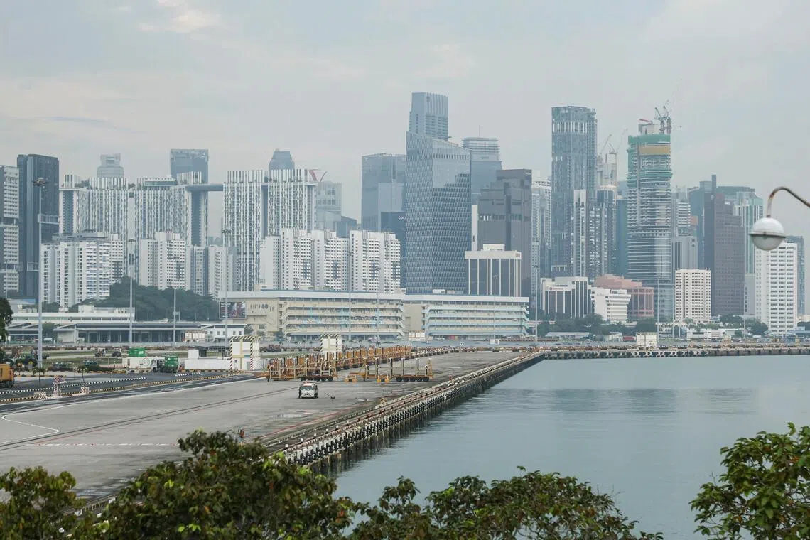
On Oct 29, the 24-hour PSI reading for the central region was 68 at 8am, in the moderate range, while the one-hour PM2.5 reading was 21, in the normal band.
Published Oct 29, 2026, 06:46 PM
Updated Oct 29, 2026, 06:46 PM
SINGAPORE - Changing wind conditions due to the onset of the inter-monsoon in Singapore will likely lower the risk of transboundary haze affecting the Republic, the weatherman said on Oct 29.
“With the shift from persistent southeasterly or southwesterly winds to light and variable winds in the surrounding region, smoke haze is less likely to be transported from fires towards Singapore,” said the Meteorological Service Singapore (MSS).
Together with wetter conditions over Singapore and the nearby areas, the smoke haze situation for Singapore is expected to improve, it added in its fortnightly weather outlook.
In the first two weeks of November, moderate to heavy thundery showers are expected over parts of the island in the afternoon on most days, said MSS.
The showers may extend into the evening on a few of these days. The total rainfall for the next two weeks is forecast to be slightly above its long-term average over most parts of the island.
It is expected to remain warm, as the daily highest temperatures are expected to range between 33 deg C and 35 deg C on most days, with the mercury slightly exceeding 35 deg C Celsius on a few days.
Since Oct 26, Singapore has been seeing clearer skies with the 24-hour Pollutant Standards Index (PSI) within the good to moderate range in all parts of the island.
As at 4pm on Oct 29, the PSI was in the good to moderate range, and the levels of PM2.5 - the main pollutant contributing to haze - remained largely in the normal range.
In the west region, PM2.5 levels crept into the elevated range of 57 at 11am before dropping to the normal range an hour later.
While wind conditions may be favourable for Singapore, the fires are still burning in Indonesia. Straits Times checks on the ASEAN Specialised Meteorological Centre’s (ASMC) website still show hotspots in Kalimantan.
Over the past few days, however, the number of fires in Indonesia seems to have dropped due to long-awaited rainfall. On Oct 24, Palembang in South Sumatra - one of the regions alongside Kalimantan that has been raging in forest fires for months - saw its first heavy downpour in three months.
ASMC said the hotspot and smoke haze situation may improve in areas experiencing showers but also continue to stay elevated in places with prolonged periods of dry weather.
The MSS said that inter-monsoon conditions have been progressively setting in over Singapore and the surrounding region with the weakening of the south-west monsoon.
That monsoon season is characterised by winds blowing from the south, which had pushed the pollution from the fires in Indonesia to Singapore over the past two months. The south-west monsoon season started around June.
Singapore has two main monsoon seasons, the other being the north-east monsoon season, which occurs between December and early March.
Inter-monsoon periods between the two dominant monsoons are characterised by lighter, more variable winds. Increased showers and higher lightning activity are also common features of the inter-monsoon periods.
In 2026, the ongoing super El Nino climate phenomenon appears to have extended the dry south-west monsoon by a month.
The inter-monsoon period usually sets in around early October.
Minister for Sustainability and the Environment Grace Fu had said in mid October that when the rainy north-east monsoon brings wind from the north around early December, any haze from Sumatra and Kalimantan will blow in the direction away from Singapore.
Giving an update on the weather over the past two weeks, MSS said short-lived thundery showers fell over parts of the island on several days, with a few days of widespread moderate to heavy thundery downpours.
On Oct 21, heavy rain fell over western Singapore in the afternoon, recording the fortnight’s highest daily rainfall of 81mm at Tuas South.
Temperatures also exceeded 34 deg C on most days, with the highest reading of 36.1 deg C at Woodlands on Oct 23.
10 月 29 日上午 8 点,中心地区的 24 小时 PSI 读数为 68,属于中等范围;而 1 小时 PM2.5 读数为 21,属于正常范围。
发布于 2026 年 10 月 29 日下午 6:46
更新于2026年10月29日下午6:46
新加坡——气象员于10月29日表示,由于新加坡进入季风间歇期,风况发生变化,跨境雾霾影响新加坡的风险可能会降低。
新加坡气象局(MSS)表示:“随着周边地区持续的东南风或西南风转变为微弱且多变的风,烟雾不太可能从火灾中向新加坡飘散。”
该机构在其两周一次的天气展望中补充说,随着新加坡及其附近地区降雨量的增加,新加坡的烟霾情况预计将会改善。
气象局表示,11 月的前两周,岛上大部分时间下午都会有中到大雷阵雨。
未来几天,阵雨可能会持续到晚上。预计未来两周,岛上大部分地区的总降雨量将略高于长期平均水平。
预计天气将持续温暖,大多数日子里,每日最高气温预计在 33 摄氏度到 35 摄氏度之间,少数日子气温可能会略微超过 35 摄氏度。
自 10 月 26 日以来,新加坡的天空变得更加晴朗,全岛各地的 24 小时污染物标准指数 (PSI) 均处于良好至中等水平。
截至 10 月 29 日下午 4 点,空气污染指数 (PSI) 处于良好至中等水平,而导致雾霾的主要污染物 PM2.5 的浓度也基本处于正常范围内。
在西部地区,PM2.5 浓度在上午 11 点攀升至 57 的较高水平,一小时后降至正常水平。
虽然新加坡的风向可能有利,但印尼的火灾仍在燃烧。《海峡时报》查阅东盟专业气象中心(ASMC)网站后发现,加里曼丹岛仍有火点。
然而,过去几天,由于期盼已久的降雨,印尼的火灾数量似乎有所下降。10月24日,南苏门答腊省的巨港市——与加里曼丹省一样,已遭受数月森林火灾肆虐——迎来了三个月来的第一场强降雨。
ASMC表示,在有降雨的地区,热点和烟雾情况可能会有所改善,但在持续干旱的地区,情况仍将居高不下。
新加坡气象局表示,随着西南季风减弱,新加坡及其周边地区正逐渐进入季风间歇期。
这个季风季节的特点是盛行南风,过去两个月里,正是这种南风将印尼山火产生的污染吹到了新加坡。西南季风季节大约从六月开始。
新加坡有两个主要的季风季节,另一个是东北季风季节,通常在 12 月到 3 月初之间。
两大主要季风之间的季风间歇期,风力较弱且变化无常。降雨增多和雷电活动增强也是季风间歇期的常见特征。
2026年,持续的超级厄尔尼诺气候现象似乎使西南季风的干旱期延长了一个月。
季风间歇期通常在十月初开始。
新加坡永续发展及环境部长傅海燕在 10 月中旬曾表示,12 月初左右,当东北季风带来北风时,来自苏门答腊和加里曼丹的任何雾霾都会吹离新加坡。
MSS 更新了过去两周的天气情况,称岛上部分地区连续几天出现短暂的雷阵雨,其中几天出现大范围的中到大雨。
10 月 21 日下午,新加坡西部普降暴雨,大士南区录得两周以来最高的单日降雨量 81 毫米。
大多数日子里气温也超过了 34 摄氏度,10 月 23 日伍德兰兹的最高气温达到了 36.1 摄氏度。