India to build strategic outpost near key shipping lane in Indo-Pacific印度将在印太地区重要航道附近建立战略前哨基地。
“This is what I call the Hormuz Strait effect," one analyst said, referring to the collapse of shipping through the vital waterway due to war.
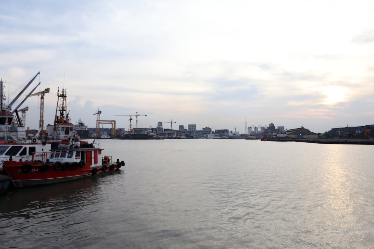
NEW DELHI — India is pressing ahead with a $9 billion infrastructure project to bolster its military footprint on the Great Nicobar Island which sits far from the Indian mainland near one of the world’s most critical shipping arteries.
The project is attracting attention as disruptions to shipping in the Strait of Hormuz, following the U.S.-Iran-Israel conflict brings focus to other vulnerable maritime chokepoints.
The Malacca Strait, a narrow stretch of water passing between Indonesia, Malaysia and Singapore, is the shortest route between the Indian Ocean and the South China Sea. Jointly managed by these three countries, it carries more than a quarter of global sea trade. It is particularly crucial for China because a bulk of its maritime trade including nearly three quarters of its imported crude oil supplies transits these waters.
Part of India’s far-flung Andaman and Nicobar archipelago, the Great Nicobar island lies closer to Indonesia than the Indian mainland and has long been eyed as a potential defense outpost in the Indo Pacific and a gateway to the Malacca Strait. It is located about 150 kilometers from the strait’s western entrance.
An infographic titled "Strategic maritime chokepoints in global oil trade" created in Istanbul, Turkey, on June 18, 2025. (Muhammed Ali Yigit/Anadolu via Getty Images)
The project, which involves developing the island as a trading and maritime hub, got the go-ahead after environmental concerns raised about its impact on the ecosystem were set aside in February by the National Green Tribunal, a court mandated to protect the environment. It will come up over 160 square kilometers of tropical forest land and will be implemented in three phases.
“It leverages Great Nicobar’s strategic location to strengthen India’s national security, maritime and defense presence in the Indo-Pacific while simultaneously embedding strong environmental safeguards and tribal welfare mechanisms,” the Indian government said in a press statement on May 1.
Expanding focus to the Indo-Pacific
The project will include building an international container trans-shipment terminal, a dual-use civil and military airport, a power plant, and a township at Galathea Bay in the Great Nicobar Island.
Analysts say expanding existing airstrips on the island will facilitate operations of fighter jets and surveillance aircraft while building new jetties and logistics hubs will boost naval operations .
The aim is to extend India’s defense focus from its mainland along some of the world’s busiest shipping routes.
“It enhances India’s ability in the maritime space whether it is for surveillance, monitoring of shipping traffic, or potential naval operations. Great Nicobar Island has been talked of as a permanent forward base for military power projection. So essentially it strengthens India’s presence in the Indo-Pacific,” according to Harsh Pant, vice president at the Observer Research Foundation in New Delhi.
Satellite imagery captures the southern tip of Great Nicobar Island, specifically Galathea Bay, in India. (Gallo Images/Orbital Horizon/Copernicus Sentinel Data 2024)
The current crisis in the Hormuz Strait, where sea traffic remains virtually paralyzed since the Iran conflict erupted has underlined the need to strengthen India’s deterrence posture and secure trade routes, according to retired Brigadier Arun Sahgal, who directs the Forum for Strategic Initiatives in New Delhi.
“This is what I call the Hormuz Strait effect. We are now looking at the possibility that waterways can be militarily dominated. So the idea is to develop Nicobar into a credible military outpost to oversee the security of Malacca waters and ensure that any inimical player, be it Chinese or the United States, they do not interfere in the maritime traffic in a manner that is being done by both Iran and the U.S. in Hormuz,” said Sahgal.
Even as India leverages its geography to its advantage at Great Nicobar, analysts point out that countering its regional rival, China, is a key factor behind the project.
While both countries have long confronted each other along their rugged Himalayan borders, India also faces a maritime challenge from Beijing as China edges closer to its coast. Beijing has built ports in Indian Ocean countries like Sri Lanka and Pakistan , and road and rail links in Myanmar to gain overland access to the Indian Ocean. Chinese submarines and surveillance ships traverse these waters regularly.
A fishing boat is moored near Campbell Bay at Great Nicobar island on March 28, 2026. (R.Satish BABU / AFP via Getty Images)
“In some ways developing this project allows India to push back against China in its own way because Beijing is intruding into India’s strategic space,” says strategic affairs expert Pant. “This ability to transform Indian territory for maritime power projection is going to be critical at a time when Indo-Pacific competition is getting enhanced. At the same time, India also benefits economically.”
Other analysts stress that the project is important for India, which calls itself a “net security provider” in the Indian Ocean.
“The influence of the Chinese navy is only likely to increase from now on to ensure that sea lanes are not interfered with. It is imperative for India also to ensure freedom of navigation if it has to keep its leverage in this region,” according to Sahgal.
新德里——印度正在推进一项耗资 90 亿美元的基础设施项目,以加强其在大尼科巴岛上的军事存在。大尼科巴岛远离印度大陆,靠近世界上最重要的航运动脉之一。
在美国、伊朗和以色列冲突之后,霍尔木兹海峡的航运受到干扰,其他脆弱的海上咽喉要道也因此受到关注,该项目也因此备受关注。
马六甲海峡是连接印度尼西亚、马来西亚和新加坡的一条狭窄水道,也是印度洋和南海之间最短的航道。该海峡由这三个国家共同管理,承担着全球超过四分之一的海上贸易。它对中国尤为重要,因为中国大部分海上贸易,包括近四分之三的原油进口,都要经过这里。
大尼科巴岛是印度遥远的安达曼-尼科巴群岛的一部分,它比印度大陆更靠近印度尼西亚,长期以来一直被视为印度洋-太平洋地区潜在的防御前哨和通往马六甲海峡的门户。它位于马六甲海峡西入口约150公里处。
一张题为“全球石油贸易中的战略性海上咽喉要道”的信息图于2025年6月18日在土耳其伊斯坦布尔制作完成。(Muhammed Ali Yigit/Anadolu via Getty Images)
该项目旨在将该岛开发成贸易和海运中心,此前曾有人对其对生态系统的影响提出环境方面的担忧,但国家绿色法庭(一个负责环境保护的法院)于今年2月驳回了这些担忧,项目才得以批准。该项目将占地160平方公里热带森林,分三个阶段实施。
印度政府在5月1日的一份新闻声明中表示:“该项目利用大尼科巴岛的战略位置,加强印度在印太地区的国家安全、海上和国防存在,同时融入强有力的环境保护措施和部落福利机制。”
将关注重点扩展至印度-太平洋地区。
该项目将在大尼科巴岛的加拉西亚湾建设一个国际集装箱转运码头、一个军民两用机场、一个发电厂和一个城镇。
分析人士表示,扩建岛上现有的简易机场将有利于战斗机和侦察机的行动,而建造新的码头和后勤中心将促进海军行动。
其目的是将印度的国防重心从本土扩展到世界上一些最繁忙的航运路线。
新德里观察家研究基金会副总裁哈什·潘特表示:“无论是在监视、监控航运,还是潜在的海军行动方面,它都增强了印度在海洋领域的能力。大尼科巴岛一直被视为军事力量投射的永久性前沿基地。因此,从本质上讲,它加强了印度在印太地区的存在。”
卫星图像捕捉到了印度境内大尼科巴岛南端,具体来说是加拉西亚湾的景象。(Gallo Images/Orbital Horizon/哥白尼哨兵卫星数据 2024)
据新德里战略倡议论坛主任、退役准将阿伦·萨加尔称,自伊朗冲突爆发以来,霍尔木兹海峡的海上交通几乎瘫痪,目前的危机凸显了加强印度威慑态势和保障贸易路线安全的必要性。
“这就是我所说的霍尔木兹海峡效应。我们现在面临的问题是,水道可能被军事力量控制。因此,我们的想法是将尼科巴群岛发展成为一个可靠的军事前哨,以监督马六甲水域的安全,并确保任何敌对势力,无论是中国还是美国,都不会像伊朗和美国在霍尔木兹海峡所做的那样,干涉海上交通,”萨加尔说道。
尽管印度在大尼科巴岛利用其地理优势,但分析人士指出,对抗其地区竞争对手中国是该项目背后的一个关键因素。
尽管印巴两国长期以来在崎岖的喜马拉雅山脉边界上对峙,但随着中国不断逼近其海岸线,印度还面临着来自北京的海上挑战。北京已在斯里兰卡和巴基斯坦等印度洋沿岸国家修建港口,并在缅甸修建公路和铁路,以获得进入印度洋的陆路通道。中国的潜艇和侦察船也经常在这些海域活动。
2026年3月28日,一艘渔船停泊在大尼科巴岛坎贝尔湾附近。(R.Satish BABU / AFP via Getty Images)
战略事务专家潘特表示:“从某种程度上说,发展这个项目让印度能够以自己的方式反击中国,因为北京正在侵入印度的战略空间。在印太地区竞争日益激烈的当下,这种将印度领土改造为海上力量投射基地的能力至关重要。与此同时,印度也能从中获得经济利益。”
其他分析人士强调,该项目对印度非常重要,印度自诩为印度洋的“净安全提供者”。
萨加尔表示:“中国海军的影响力只会与日俱增,以确保海上航道不受干扰。如果印度想要保持其在该地区的影响力,确保航行自由对印度来说也至关重要。”