Johor identifies 337 flood hotspots as state braces for northeast monsoon柔佛州确定337个洪水高发区,严阵以待迎接东北季风
PASIR GUDANG, Nov 3 — The Johor government will focus on 337 flood hotspots statewide as the northeast monsoon is expected to affect the state from this month until January...
The Johor government is prioritizing flood management in 337 identified hotspots across the state, in anticipation of the northeast monsoon from November to January.
Key initiatives include hotspot mapping, drainage maintenance, and the use of the eBencana reporting system.
The state plans to execute immediate maintenance tasks and has requested an emergency allocation of up to RM30 million for preparedness measures, while long-term projects like embankments and flood walls are in planning stages.
PASIR GUDANG, Nov 3 — The Johor government will focus on 337 flood hotspots statewide as the northeast monsoon is expected to affect the state from this month until January next year.
State Public Works, Transport, Infrastructure and Communications Committee chairman Mohamad Fazli Mohamad Salleh said priority would be given to areas with high population density and a history of major flooding, including the districts of Kota Tinggi, Batu Pahat and Segamat.
“Based on updates from the Department of Irrigation and Drainage (DID), 35 flood hotspots, including new additions, have been identified.
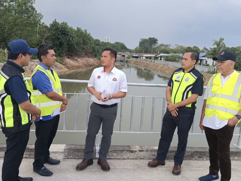
“The Public Works Department (JKR) has also identified 30 high-risk road locations that comprise 21 sites on federal roads and nine on state roads,” he told reporters after a working visit to the Sungai Rinting flood wall project here today.
Also present were Permas assemblyman Baharudin Mohamed Taib and senior government agency officials.
Mohamad Fazli said the measures outlined included hotspot mapping, drain maintenance, cleaning and dredging drainage systems, ensuring machinery was ready, public outreach and the use of the eBencana (electronic disaster) reporting system.
He said the relevant projects included Phase 1 of the Sungai Johor Flood Mitigation Plan, the Sungai Pemandi Flood Mitigation Plan and a flood alleviation project in Kampung Sungai Kapal Lama in Pengerang.
In Batu Pahat, Mohamad Fazli said the DID had identified 41 flood hotspots, while the JKR had detected 21 high-risk locations along federal and state roads, covering a total distance of 6.5 kilometres.
He added that preparations would include road pavement maintenance works worth RM11.79 million, non-pavement works worth RM3.20 million and an allocation of RM1.92 million under the Malaysian Road Records Information System (MARRIS) for drainage-related works.
“Alternative route plans via the FT024 federal road and the PLUS Highway have also been planned.
“Mobile pumps at the Parit Botak sluice gate, flood mitigation projects – such as the Bandar Batu Pahat and Sungai Batu Pahat flood mitigation schemes – as well as coastal embankment upgrading works, are also being given due attention,” he said.
In Segamat, Mohamad Fazli said the DID had identified 29 flood hotspots, while the JKR had identified 16 high-risk locations, comprising eight federal roads and eight state roads.
“Efforts are also focused on monitoring river levels and roadways, as well as coordinating with the Batu Pahat district, which is located downstream,” he said.
In Muar, he said 65 flood hotspots had been identified, the highest number among the districts listed by the DID.
In Tangkak, 26 hotspots had been identified, with priority measures including inspecting culverts and drainage systems, monitoring roadways and coordinating maintenance efforts among the relevant agencies.
Mohamad Fazli said there were also 44 flood hotspots in Johor Bahru, 29 in Kluang, 19 in Pontian, 27 in Kulai and 22 in Mersing.
In a related development, he said the state government was preparing an application for an emergency allocation of between RM20 million and RM30 million to carry out maintenance works and flood preparedness measures in high-risk areas throughout November and December.
“Priority will be given to tasks that can be executed immediately, specifically maintenance work, whereas large-scale projects, such as the construction of embankments and flood-retaining walls, will require a longer timeframe,” he added.
After Customs flags import irregularities, maritime expert asks MACC to revisit RM220m crude cargo report
New law replacing AUKU will not curtail students’ freedom of expression, says Zahid
Govt approves over RM250m for ECRL expansion plans and new Kota Bharu bus terminal
柔佛州政府正在优先处理全州 337 个已确定的洪水热点地区的防洪工作,以应对 11 月至 1 月的东北季风。
重点举措包括热点地区测绘、排水系统维护以及使用 eBencana 报告系统。
该州计划立即执行维护任务,并已申请高达 3000 万令吉的紧急拨款用于准备措施,而堤坝和防洪墙等长期项目则处于规划阶段。
巴西古当,11月3日讯——柔佛州政府将重点关注全州337个洪涝灾害热点地区,因为东北季风预计将从本月持续到明年1月影响该州。
州公共工程、交通、基础设施和通讯委员会主席穆罕默德·法兹利·穆罕默德·萨利赫表示,将优先考虑人口密度高且历史上曾发生过重大洪灾的地区,包括哥打丁宜、峇株巴辖和昔加末等地区。
“根据灌溉和排水部 (DID) 的最新情况,已确定 35 个洪水热点地区,包括新增地区。
“公共工程局(JKR)还确定了 30 个高风险道路地点,其中包括 21 个联邦道路地点和 9 个州级道路地点,”他今天在参观完双溪林丁防洪墙项目后告诉记者。
出席者还有柏马斯州议员巴哈鲁丁·穆罕默德·泰益和政府机构高级官员。
穆罕默德·法兹利表示,概述的措施包括热点地区测绘、排水沟维护、清理和疏浚排水系统、确保机械设备准备就绪、公众宣传以及使用 eBencana(电子灾害)报告系统。
他表示,相关项目包括柔佛河防洪计划第一阶段、彭曼迪河防洪计划以及边佳兰甘榜双溪卡帕拉玛的防洪工程。
莫哈末法兹利表示,在峇株巴辖,水利灌溉局 (DID) 已确定 41 个洪水热点地区,而公共工程局 (JKR) 已在联邦和州级公路沿线发现 21 个高风险地点,总长度达 6.5 公里。
他还补充说,准备工作将包括价值 1179 万令吉的道路路面维护工程、价值 320 万令吉的非路面工程,以及根据马来西亚道路记录信息系统 (MARRIS) 拨款 192 万令吉用于排水相关工程。
“我们还制定了经由 FT024 联邦公路和 PLUS 高速公路的替代路线方案。
“巴里特博塔克水闸的移动式水泵、防洪工程(如峇株巴辖镇和峇株巴辖河防洪工程)以及海岸堤坝升级工程也得到了应有的重视,”他说。
在昔加末,穆罕默德·法兹利表示,水利灌溉局 (DID) 已确定 29 个洪水热点地区,而公共工程局 (JKR) 已确定 16 个高风险地点,其中包括 8 条联邦公路和 8 条州级公路。
“我们还将重点放在监测河流水位和道路状况,以及与下游的峇株巴辖区进行协调,”他说。
他表示,在麻坡,已确定了 65 个洪水热点地区,是水利灌溉局列出的各区中数量最多的。
在东甲,已确定了 26 个热点地区,优先措施包括检查涵洞和排水系统、监测道路以及协调相关机构之间的维护工作。
Mohamad Fazli表示,新山还有44个洪水热点,居銮有29个,笨珍有19个,古来有27个,丰盛港有22个。
他还表示,州政府正在准备申请2000万至3000万令吉的紧急拨款,用于在11月和12月期间对高风险地区进行维护工作和防洪措施。
“我们将优先处理可以立即执行的任务,特别是维护工作,而像堤坝和防洪墙建设这样的大型项目则需要更长的时间,”他补充道。
海关发现进口违规行为后,海事专家要求反贪污委员会重新审查价值2.2亿令吉的原油货物报告。
扎希德表示,取代AUKU的新法律不会限制学生的言论自由。
政府批准超过2.5亿令吉用于东海岸铁路扩建计划和新建哥打巴鲁巴士总站。