Sarawak Forestry ramps up monitoring in fire-prone forests as heat, haze raise risks to wildlife砂拉越林业局加强对易燃森林的监测,因为高温和雾霾加剧了野生动物面临的风险。
KUCHING, Sept 4 — Sarawak Forestry Corporation (SFC) is stepping up monitoring in high-risk forest areas amid the current hot, dry and hazy weather, which could heighten the...
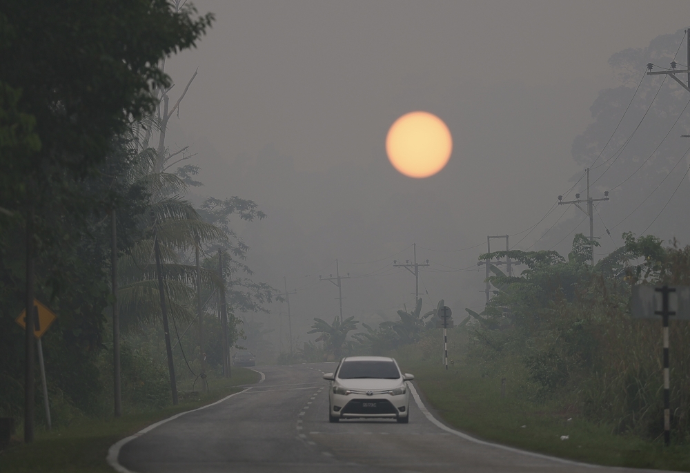
The Sarawak Forestry Corporation (SFC) is intensifying monitoring efforts in high-risk forest areas, particularly peat forests, amid dry and hazy conditions that elevate forest fire risks.
Surveillance strategies include field patrols and using technology for early fire detection, with a focus on previously affected Totally Protected Areas.
SFC is also prepared for wildlife emergencies and health risks due to smoke and haze.
They emphasize a more systematic preparedness approach, updating guidelines to prevent, detect early, and manage fires effectively, considering climate change challenges.
Transboundary haze has notably impacted several areas in Sarawak, with Serian reaching hazardous air pollution levels.
KUCHING, Sept 4 — Sarawak Forestry Corporation (SFC) is stepping up monitoring in high-risk forest areas amid the current hot, dry and hazy weather, which could heighten the risk of forest fires.
SFC general manager Abang Arabi Abang Aimran said the situation warranted close attention as the prevailing conditions could place additional pressure on forest ecosystems and wildlife.
“We conduct monitoring, particularly in peat forest areas and areas close to human activities. Field patrols are also carried out, while hotspot information and technology are used to detect early signs of fire.
“Based on past incidents, we are focusing more on monitoring Totally Protected Areas (TPAs) that have previously been affected by forest fires,” he told
Among the areas being closely monitored are Sibuti Wildlife Sanctuary, Piasau Nature Reserve, Lambir National Park, Niah National Park and Mulu National Park in Miri, as well as Samunsam Wildlife Sanctuary, Bako National Park and Kuching Wetland National Park in Kuching, and Bukit Lima Nature Reserve in Sibu.
Abang Arabi said SFC was also prepared to respond to wildlife injuries caused by forest fires, as well as health problems resulting from exposure to heavy smoke and haze.
He said the preparations included having emergency equipment and trained personnel, including SFC veterinary officers, on standby to enable immediate action to be taken in the event of an emergency.
“Working with private veterinary centres and the Department of Veterinary Services is also part of our strategy to address wildlife health issues,” he said.
Abang Arabi said climate change, which contributes to hotter and drier conditions, required SFC to adopt a more systematic approach to preparedness.
“In this regard, we regularly assess the situation and update existing guidelines and standard operating procedures (SOPs).
“Our goal is not only to respond to fires, but more importantly, to prevent them, detect them early and protect forests and wildlife before the situation worsens,” he said.
Transboundary haze has affected several areas in Sarawak since early August.
According to the Department of Environment (DOE)’s Malaysian Air Pollutant Index Management System (APIMS) portal, the Air Pollutant Index (API) reading in Serian stood at 495 as of 7 am today, placing it at the hazardous level.
Three areas recorded very unhealthy API readings, namely Kuching (289), Samarahan (265) and Sri Aman (250). — Bernama
Malaysian durians could clear China customs in three to four hours under proposed fast-track scheme
Anwar: Malaysia, Macau to strengthen strategic ties and unlock new business opportunities
MACC drops orange garb requirement for suspects brought to court for remand
砂拉越林业公司(SFC)正在加强对高风险森林地区,特别是泥炭森林的监测工作,因为干燥和雾霾天气加剧了森林火灾的风险。
监测策略包括实地巡逻和利用技术进行早期火灾探测,重点关注以前受影响的完全保护区。
SFC也已做好应对野生动物紧急情况以及烟雾和霾造成的健康风险的准备。
他们强调采取更系统的准备方法,更新指导方针,以有效预防、及早发现和控制火灾,同时考虑到气候变化带来的挑战。
跨境雾霾对砂拉越多个地区造成了显著影响,其中西连的空气污染达到了危险级别。
古晋,9月4日讯——鉴于当前炎热、干燥和雾霾天气可能加剧森林火灾风险,砂拉越森林机构(SFC)正在加强对高风险森林地区的监测。
新加坡森林管理委员会总经理阿邦·阿拉比·阿邦·艾姆兰表示,这种情况值得密切关注,因为当前的情况可能会给森林生态系统和野生动物带来额外的压力。
“我们开展监测工作,尤其是在泥炭林地区和靠近人类活动的区域。我们还会进行实地巡逻,同时利用热点信息和技术来探测火灾的早期迹象。”
“根据以往的事件,我们正更加注重监测以前受森林火灾影响的完全保护区(TPA)。”他说道。
受到密切监测的地区包括美里的西布蒂野生动物保护区、皮亚绍自然保护区、兰比尔国家公园、尼亚国家公园和姆鲁国家公园,以及古晋的萨蒙萨姆野生动物保护区、巴科国家公园和古晋湿地国家公园,还有诗巫的武吉利马自然保护区。
阿邦阿拉比表示,新加坡森林管理局也已做好准备,应对森林火灾造成的野生动物受伤事件,以及因暴露于浓烟和霾中而导致的健康问题。
他表示,准备工作包括配备应急设备和训练有素的人员(包括新加坡兽医局的兽医官)待命,以便在发生紧急情况时能够立即采取行动。
他说:“与私人兽医中心和兽医服务部门合作也是我们解决野生动物健康问题战略的一部分。”
阿邦阿拉比表示,气候变化导致气候更加炎热干燥,因此新加坡林业局需要采取更加系统的应对措施。
“在这方面,我们会定期评估情况,并更新现有的指导方针和标准操作程序(SOP)。
他说:“我们的目标不仅是应对火灾,更重要的是预防火灾,及早发现火灾,并在情况恶化之前保护森林和野生动物。”
自8月初以来,跨境雾霾已经影响到砂拉越的多个地区。
根据环境部(DOE)的马来西亚空气污染指数管理系统(APIMS)门户网站显示,截至今天早上7点,西连的空气污染指数(API)读数为495,处于危险水平。
三个地区的 API 读数非常不健康,即古晋(289)、三马拉汉(265)和斯里阿曼(250)。 — 马新社
根据拟议的快速通道方案,马来西亚榴莲可在三到四个小时内清关。
安华:马来西亚与澳门将加强战略联系,开拓新的商业机遇
反贪污委员会取消对被带到法庭还押候审的嫌疑人穿橙色服装的要求