Report: Iran used commercial satellite images to monitor US forces before attack报道称:伊朗在发动袭击前利用商业卫星图像监视美军。
The news report said Iran monitored the base by purchasing commercial satellite images, but the U.S. military was wise to the efforts.
UPDATE: Added response from U.S. Central Command.
WASHINGTON — Iran used commercial satellite images to monitor Ain al-Asad Air Base in Iraq as it prepared to launch more than a dozen ballistic missiles at U.S. and coalition forces, 60 Minutes reported.
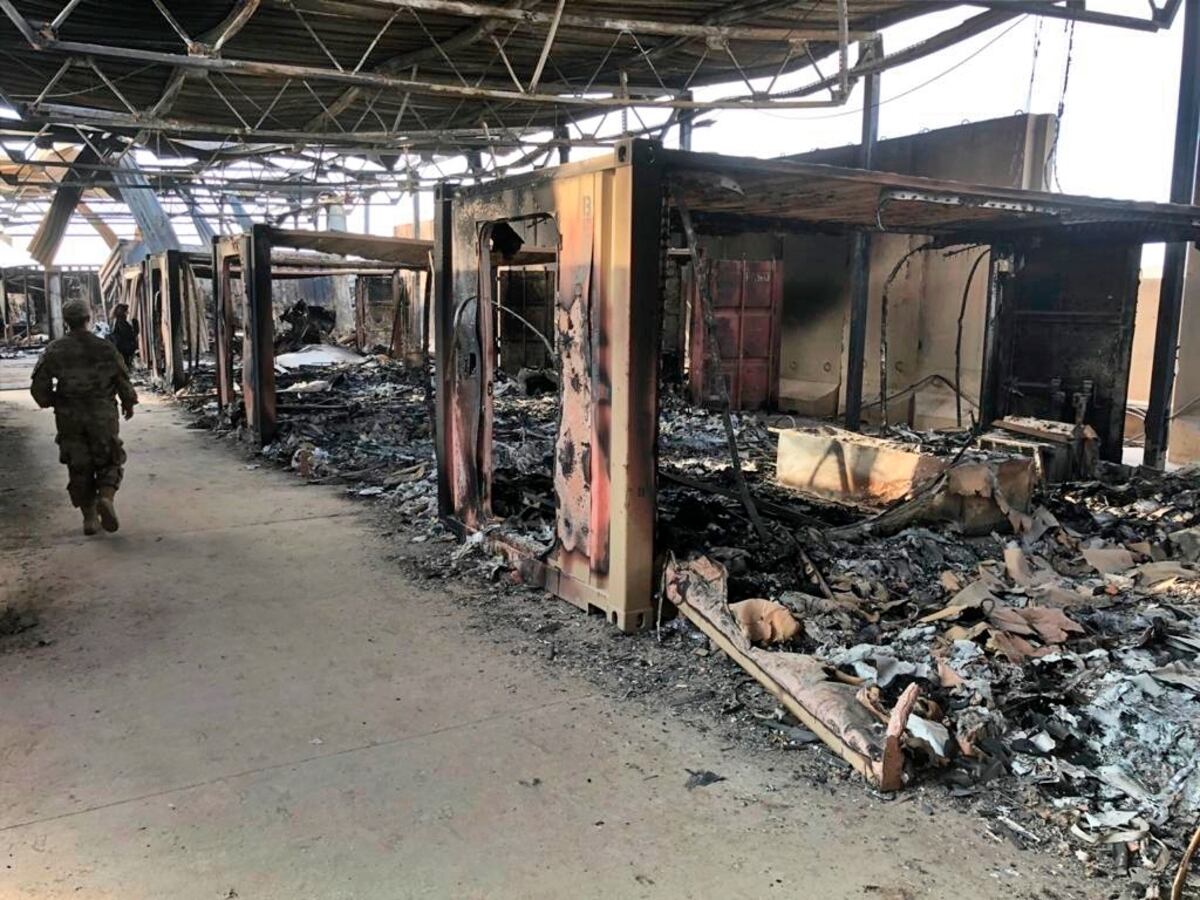
That detail came more than a year after the night of the attack on Jan. 7, 2020. Iran said the barrage was “fierce revenge” for the assassination of Gen. Qassem Soleimani, killed by the U.S. in a drone strike days earlier. The missile attack damaged the base , equipment and a helicopter, and 110 people had to be treated for traumatic brain injuries . But no one was killed, thanks in part to early intelligence that an attack was imminent and a critical early warning from the Space Force’s missile warning satellite operators .
The 60 Minutes report revealed new details about the timing of the evacuation, and how Iran tried to use commercially available satellite imagery to monitor the base.
The report said that Iran purchased satellite images of the base on the day of the attack, and U.S. Central Command was aware of it. According to CBS News national security correspondent David Martin, USCENTCOM Commander Gen. Frank McKenzie timed the evacuation of al-Asad Air Base around Iran’s purchase of satellite imagery of the base.
“If you go too early, you risk the problem that the enemy will see what you have done and adjust his plans,” McKenzie told the reporter.
McKenzie waited until Iran had purchased its last satellite image of the day before evacuating the base, ensuring that Iran was acting on out-of-date images, he said in the interview.
“They would have seen airplanes on the ground and people working,” said McKenzie. “I think they expected to destroy a number of U.S. aircraft and to kill a number of U.S. service members.”
In a statement, USCENTCOM told C4ISRNET that it “does assess that Iran uses commercial satellite imagery from a variety of sources.” It declined to answer further questions.
Unclassified footage of Iran's tactical ballistic missile strikes on Ain al-Asad airb ase Jan. 8, 2020. No one was killed in the attack. (Central Command)
It is not clear which satellite imagery provider Iran purchased the images from.
The U.S. intelligence community and the Department of Defense buy commercial satellite imagery for a number of different uses. The National Geospatial-Intelligence Agency purchases unclassified commercial images to share with other government organizations, while the National Reconnaissance Office is using study contracts to determine what commercial imagery it will purchase for the intelligence community . The military is also showing increased interest in the growing commercial satellite imagery market, signing agreements with various companies for images and real-time analytics. In September, the U.S. Army experimented with using commercial imagery for beyond-line-of-sight targeting .
It’s also not clear how the U.S. military knew Iran was purchasing the images, or how it knew when images of al-Asad Air Base were purchased.
Nathan Strout covers space, unmanned and intelligence systems for C4ISRNET.
更新:已添加美国中央司令部的回应。
华盛顿——据《60分钟》报道,伊朗利用商业卫星图像监控伊拉克阿萨德空军基地,准备向美国和联军发射十几枚弹道导弹。
这一细节是在2020年1月7日袭击事件发生一年多后才公布的。伊朗称,此次导弹袭击是对美国几天前无人机袭击中苏莱曼尼将军遇刺身亡的“猛烈报复”。导弹袭击损坏了基地、设备和一架直升机,110人因脑外伤接受治疗。但无人死亡,部分原因是早期情报显示袭击即将发生,以及太空部队导弹预警卫星运营商发出的关键预警。
《60 分钟》的报道揭露了有关撤离时间的新细节,以及伊朗如何试图利用市面上可获得的卫星图像来监控该基地。
报告称,伊朗在袭击当天购买了该基地的卫星图像,而美国中央司令部对此知情。据哥伦比亚广播公司新闻国家安全记者大卫·马丁报道,美国中央司令部司令弗兰克·麦肯齐将军特意安排阿萨德空军基地的人员疏散时间,与伊朗购买该基地卫星图像的时间吻合。
麦肯齐告诉记者:“如果你行动过早,敌人可能会看到你的行动并调整计划,从而带来风险。”
麦肯齐在采访中表示,他等到伊朗购买了当天最后一张卫星图像后才撤离基地,以确保伊朗是根据过时的图像采取行动。
麦肯齐说:“他们应该会看到地面上有飞机,也会看到有人在工作。我认为他们原本打算摧毁一些美国飞机,并杀死一些美国军人。”
美国中央司令部在一份声明中告诉C4ISRNET,它“评估认为伊朗使用了来自各种来源的商业卫星图像”。该司令部拒绝回答进一步的问题。
2020年1月8日,伊朗向阿萨德空军基地发射战术弹道导弹,未公开的录像显示,此次袭击无人死亡。(中央司令部)
目前尚不清楚伊朗是从哪家卫星图像提供商那里购买的这些图像。
美国情报机构和国防部出于多种用途购买商业卫星图像。国家地理空间情报局购买非机密商业图像与其他政府机构共享,而国家侦察局则通过研究合同来确定其将为情报机构购买哪些商业图像。军方也对日益增长的商业卫星图像市场表现出越来越浓厚的兴趣,并与多家公司签署了图像和实时分析协议。今年9月,美国陆军试验性地使用商业图像进行超视距目标定位。
目前还不清楚美国军方是如何知道伊朗正在购买这些图像的,或者是如何知道阿萨德空军基地的图像何时被购买的。
Nathan Strout 为 C4ISRNET 报道太空、无人系统和情报系统方面的新闻。