China maps ocean floor as it prepares for submarine warfare with US中国绘制海底地图,为与美国进行潜艇战做准备
Dozens of Chinese research vessels are on a quest to map the sea floor at strategically vital regions of the world's oceans.
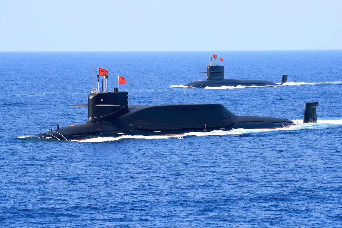
SYDNEY — China is conducting a vast undersea mapping and monitoring operation across the Pacific, Indian and Arctic oceans, building detailed knowledge of marine conditions that naval experts say would be crucial for waging submarine warfare against the United States and its allies.
In one example, the Dong Fang Hong 3, a research vessel operated by Ocean University of China, spent 2024 and 2025 sailing back and forth in the seas near Taiwan and the U.S. stronghold of Guam , and around strategic stretches of the Indian Ocean, ship-tracking data reviewed by Reuters shows.
In October 2024, it checked on a set of powerful Chinese ocean sensors capable of identifying undersea objects near Japan, according to Ocean University, and visited the same area again last May. And in March 2025, it criss-crossed the waters between Sri Lanka and Indonesia, covering approaches to the Malacca Strait, a critical chokepoint for maritime commerce.
According to the university, the ship was carrying out mud surveys and climate research. But a scientific paper co-written by Ocean University academics shows it has also conducted extensive deep-sea mapping.
Naval-warfare experts and U.S. Navy officials say the type of deep-sea data being collected by the Dong Fang Hong 3 – via mapping and placement of sensors in the ocean – is giving China a picture of the subsea conditions it would need to deploy its submarines more effectively and hunt down those of its adversaries.
Dong Fang Hong 3, a deep-sea research vessel, docks at a pier in Qingdao, Shandong province, China. (cnsphoto via Reuters)
The Dong Fang Hong 3 isn’t operating alone. It is part of a broader ocean mapping and monitoring operation involving dozens of research vessels and hundreds of sensors.
In tracing this effort, Reuters examined Chinese government and university records, including journal articles and scientific studies, and analyzed more than five years of movement by 42 research vessels active in the Pacific, Indian or Arctic oceans using a ship-tracking platform built by New Zealand company Starboard Maritime Intelligence.
While the research has civilian purposes – some of the surveying covers fishing grounds or areas where China has mineral prospecting contracts – it also serves a military one, according to nine naval-warfare experts who reviewed Reuters’ findings.
To gather information about underwater terrain, research vessels map the sea floor while traveling back and forth in tight lines. The tracking data shows that type of movement by the vessels Reuters tracked across large sections of the Pacific, Indian and Arctic oceans.
At least eight of the vessels Reuters tracked have conducted seabed mapping, while another 10 have carried equipment used for mapping, according to a review of Chinese state media articles, vessel descriptions published by Chinese universities, and press releases by government organizations.
The vessels’ survey data “would be potentially invaluable in preparation of the battlespace” for Chinese submarines, said Peter Scott, a former chief of Australia’s submarine force. “Any military submariner worth his salt will put a great deal of effort into understanding the environment he’s operating in.”
The ship-tracking data show that China’s seabed-surveying effort is focused in part on militarily important waters around the Philippines, near Guam and Hawaii, and near U.S. military facilities on Wake atoll in the north Pacific.
“The scale of what they’re doing is about more than just resources,” said Jennifer Parker, an adjunct professor of defense and security at the University of Western Australia and former Australian anti-submarine warfare officer. “If you look at the sheer extent of it, it’s very clear that they intend to have an expeditionary blue-water naval capability that also is built around submarine operations.”
Moreover, Parker and other experts added, even where data is gathered for scientific purposes, the integration of civilian scientific research and military technology development has become a key focus of the Chinese government under President Xi Jinping. Beijing refers to this approach as “civil-military fusion.”
China’s ministries of defense, foreign affairs and natural resources didn’t respond to requests for comment about the seabed mapping and ocean-monitoring activities.
The U.S. Defense Department didn’t respond to questions from Reuters.
Los Angeles-class fast-attack submarines USS Annapolis and USS Asheville in formation off the coast of Guam, Dec. 17, 2025. (Lt. James Caliva/U.S. Navy)
In testimony to a congressional commission this month, Rear Admiral Mike Brookes, the commander of the U.S. Office of Naval Intelligence, said China had dramatically expanded its surveying efforts, providing data that “enables submarine navigation, concealment, and positioning of seabed sensors or weapons.”
He added that “potential military intelligence collection” by Chinese research vessels “represents a strategic concern.”
America recently overhauled its own efforts to map and monitor the ocean, but it typically does so with military vessels that are allowed to turn off the tracking system monitored by civilian software. China’s civilian survey ships also sometimes disable tracking, meaning its campaign may go further than Reuters could determine.
This is the first time the extent of China’s mapping and monitoring across the Pacific, Indian and Arctic oceans has been reported. Previous reporting has revealed a portion of the effort around Guam and Taiwan, and in parts of the Indian Ocean.
“It is frankly astonishing to see the enormous scale of Chinese marine scientific research,” said Ryan Martinson, an associate professor specializing in Chinese maritime strategy at the U.S. Naval War College.
“For decades, the U.S. Navy could assume an asymmetric advantage in its knowledge of the ocean battlespace,” added Martinson. China’s efforts “threaten to erode that advantage. It is obviously deeply concerning.”
The data that Chinese research vessels are collecting about the seabed and water conditions is critical to submarine operations and anti-submarine warfare, according to naval experts. Most obviously, said Australian defense scholar Parker, commanders need information about underwater terrain to avoid collisions and hide their vessels.
But that data is also essential for detecting submarines, which operate within a few hundred meters of the surface. Typically, submarines are identified through the sounds they emit or echoes from signals sent by sonar systems.
Tom Shugart, a former U.S. submarine commander who is now an adjunct senior fellow at the Center for a New American Security, said the movement of those sound waves changes depending on the underwater landscape.
Sound waves and submarine movements are also affected by water temperature, salinity and currents.
The vessels involved belong to Chinese state entities like the Ministry of Natural Resources or state-affiliated research institutions like Ocean University, whose president in 2021 publicly celebrated its “close ties” to China’s navy and commitment to “the construction of a maritime power and national defense.” The university didn’t respond to a request for comment.
China has done its most comprehensive ocean surveying east of the Philippines, which sits along the First Island Chain, the string of territories largely controlled by America’s allies that runs from the Japanese islands in the north through Taiwan and on to Borneo in the south. The chain forms a natural barrier between China’s coastal seas and the Pacific.
“They’re paranoid about being boxed in to the First Island Chain,” said Peter Leavy, formerly Australia’s naval attache to the U.S. and now president of the Australian Naval Institute. China’s mapping “indicates a desire to understand the maritime domain so they can break out.”
The tracking data shows that China’s mapping also covers waters surrounding Guam – where some American nuclear submarines are stationed.
Strikingly, Chinese vessels have also mapped waters around Hawaii, one of America’s other regional military hubs; examined an underwater ridge north of a naval base in Papua New Guinea to which the U.S. recently gained access; and scouted around Christmas Island, an Australian territory on a route between the South China Sea and a vital Australian submarine base.
China’s efforts extend further. It has mapped large swaths of the Indian Ocean, a critical route for Chinese imports of oil and other resources from the Middle East and Africa.
“China has some key vulnerabilities when it comes to dependencies on maritime trade,” said Parker, the former anti-submarine warfare officer. The surveying “indicates that they will likely be conducting more submarine operations in the Indian Ocean.”
Shipping vessels and oil tankers line up on the eastern coast of Singapore, July 22, 2015. (Reuters)
China’s vessels have also mapped the seabed west and north of Alaska, an essential sea route into the Arctic. Beijing has identified the Arctic as a strategic frontier and declared its ambition to become a polar great power by the 2030s.
The extensive surveying and Beijing’s growing undersea capability are “symptomatic of China’s rise as a premier maritime power,” said Shugart, the former submarine commander.
Around 2014, Wu Lixin, a scientist at Ocean University, proposed an ambitious effort to create a “transparent ocean” by deploying sensors that would give China a comprehensive view of water conditions and movement through specific areas, according to a statement published by the state-affiliated Chinese Academy of Sciences. The proposal quickly received at least $85 million in support from the Shandong provincial government, according to comments by Shandong officials.
The project began in the South China Sea, where Ocean University public statements boast it has now built an observation system covering the deep-sea basin.
Brookes, the director of the U.S. Office of Naval Intelligence, told the congressional commission that China is building undersea surveillance networks that “gather hydrographic data – water temperature, salinity, currents – to optimize sonar performance and enable persistent surveillance of submarines transiting critical waterways like the South China Sea.”
After surveying the South China Sea, Chinese scientists expanded the transparent ocean project to the Pacific and Indian oceans. In the Pacific, records from the Chinese Ministry of Natural Resources, Ocean University and the Shandong government show that China has deployed hundreds of sensors, buoys and subsea arrays to detect changes in water conditions like temperature, salinity and subsea movement through the ocean east of Japan, east of the Philippines, and around Guam.
In the Indian Ocean, documents from the Chinese Academy of Sciences and Ministry of Natural Resources describe a sensor array ringing India and Sri Lanka, including along an underwater mountain range known as Ninety East Ridge. The ridge – which Chinese vessels have also combed, according to the Starboard data – is one of the world’s longest undersea mountain ranges and sits astride the approach to the strategically essential Malacca Strait, through which much of China’s oil supply passes.
Ocean University and the Institute of Oceanology, which is part of the Chinese Academy of Sciences, have said the wider network of sensors now provides China with real-time data about water conditions and subsea movements.
Some naval-warfare experts expressed caution about that claim, given technical challenges with real-time communication of data from underwater. But even delayed data is valuable, Parker said, as it could help China detect U.S. submarine operations.
Many sensors are placed in sensitive locations. For example, Reuters recently reported on a U.S. effort to fortify a key strait between Taiwan and the Philippines to cut off Chinese access to the Pacific. Ocean University studies show that China has deployed advanced sensors in parts of the strait through which U.S. submarines would move to reach the South China Sea.
Chinese scientists say these sensors monitor changes in climate and ocean conditions. But in 2017, government officials from Shandong province said the transparent ocean project was intended to “ensure maritime defense and security” and explicitly compared the project with a U.S. military effort to build an American ocean-sensor network.
Shandong’s government, the Chinese Academy of Sciences and the Institute of Oceanology didn’t respond to requests for comment.
Mapping-program founder Wu now oversees the network through the Qingdao National Laboratory for Marine Science and Technology, whose partners include China’s Naval Submarine Academy, according to the academy’s website. Wu didn’t respond to Reuters questions.
Together, China’s mapping and monitoring give it sophisticated tools to detect rival submarines and deploy its own in some of the world’s most contested waters.
“This is a manifestation of China’s far-seas reach,” said Collin Koh, a senior fellow in maritime security at Singapore’s RSIS Institute of Defence and Strategic Studies. “They now have a reasonably good picture of the maritime domain they hope to operate in, either in peacetime or in war.”
Chinese researchers, similarly, see strategic value in their work. Zhou Chun, an Ocean University researcher who oversees the Indian and Pacific ocean sensor arrays, was quoted last year in an Ocean University press release as saying that his work had shown him “the rapid development of my country’s maritime defense and military capabilities.” He didn’t respond to Reuters questions.
Going forward, Zhou pledged to “transform the most advanced scientific and technological achievements into new types of combat capabilities for our military at sea.”
悉尼——中国正在太平洋、印度洋和北冰洋开展大规模的海底测绘和监测行动,以建立详细的海洋状况知识。海军专家表示,这些知识对于对美国及其盟友发动潜艇战至关重要。
例如,路透社查阅的船舶跟踪数据显示,中国海洋大学运营的科考船“东方红3号”在2024年和2025年期间,在台湾和美国据点关岛附近的海域以及印度洋的战略要地附近来回航行。
据海洋大学称,2024年10月,该舰对一套能够识别日本附近海域水下物体的中国先进海洋传感器进行了检查,并于去年5月再次造访同一区域。2025年3月,该舰在斯里兰卡和印度尼西亚之间的海域进行了多次巡查,覆盖了通往马六甲海峡的航道,该海峡是海上贸易的关键咽喉要道。
据该大学称,这艘船当时正在进行泥沙调查和气候研究。但海洋大学学者共同撰写的一篇科学论文显示,它还进行了广泛的深海测绘。
海军作战专家和美国海军官员表示,“东方红3号”通过海洋测绘和传感器部署收集的深海数据,使中国能够了解其部署潜艇和追击对手潜艇所需的海底状况。
深海科考船“东方红3号”停靠在中国山东省青岛市码头。(图片来自路透社)
“东方红3号”并非单独作业,它是更大规模的海洋测绘和监测行动的一部分,该行动涉及数十艘科考船和数百个传感器。
为了追踪这项工作,路透社查阅了中国政府和大学的记录,包括期刊文章和科学研究,并利用新西兰公司 Starboard Maritime Intelligence 开发的船舶跟踪平台,分析了 42 艘活跃在太平洋、印度洋或北冰洋的研究船五年多的航行轨迹。
九位审阅了路透社调查结果的海军作战专家表示,虽然这项研究具有民用目的——部分调查涵盖了渔场或中国拥有矿产勘探合同的地区——但它也服务于军事目的。
为了收集水下地形信息,科考船会沿紧密航线来回航行,绘制海底地图。路透社追踪到的数据显示,这类科考船的航行路线覆盖了太平洋、印度洋和北冰洋的大片区域。
据路透社追踪的船只中,至少有 8 艘进行了海底测绘,另有 10 艘携带了用于测绘的设备。这一结论来自对中国官方媒体文章、中国大学发布的船舶描述以及政府机构新闻稿的审查。
澳大利亚前潜艇部队司令彼得·斯科特表示,这些舰艇的勘测数据“对于中国潜艇的作战环境准备可能具有不可估量的价值”。他还说:“任何称职的潜艇兵都会投入大量精力去了解他所处的环境。”
船舶跟踪数据显示,中国的海底勘测工作部分集中在菲律宾周围、关岛和夏威夷附近以及北太平洋威克环礁美国军事设施附近的具有重要军事意义的水域。
“他们行动的规模不仅仅体现在资源方面,”西澳大利亚大学国防与安全兼职教授、前澳大利亚反潜作战军官詹妮弗·帕克说,“如果你看看其规模之大,就会很清楚地看出,他们打算建立一支远征远洋海军力量,而这支力量也围绕着潜艇作战展开。”
此外,帕克和其他专家补充说,即使数据收集的目的是为了科学研究,民用科学研究与军事技术发展的融合也已成为习近平主席领导下的中国政府的重点工作。北京将这种做法称为“军民融合”。
中国国防部、外交部和自然资源部均未回应有关海底测绘和海洋监测活动的置评请求。
美国国防部没有回应路透社的提问。
2025年12月17日,洛杉矶级快速攻击潜艇“安纳波利斯”号和“阿什维尔”号在关岛海岸附近编队航行。(詹姆斯·卡利瓦中尉/美国海军)
本月,美国海军情报局局长迈克·布鲁克斯海军少将在国会委员会作证时表示,中国已大幅扩大了其勘测工作,提供了“能够实现潜艇导航、隐蔽以及海底传感器或武器定位”的数据。
他还补充说,中国科考船“潜在的军事情报收集活动”“构成战略关注”。
美国近期对其海洋测绘和监测工作进行了全面改革,但通常情况下,美国使用军用船只进行作业,这些船只可以关闭由民用软件监控的跟踪系统。中国的民用勘测船有时也会禁用跟踪功能,这意味着中国的行动范围可能超出路透社的判断。
这是首次披露中国在太平洋、印度洋和北冰洋开展测绘和监测的范围。此前的报道仅披露了关岛和台湾附近以及印度洋部分海域的部分工作。
“看到中国海洋科学研究的巨大规模,真是令人震惊,”美国海军战争学院专门研究中国海洋战略的副教授瑞安·马丁森说。
马丁森补充道:“几十年来,美国海军在海洋战场信息方面一直拥有不对称优势。中国的努力“有可能削弱这种优势。这显然令人深感担忧。”
据海军专家称,中国科考船收集的海底和水文状况数据对潜艇作战和反潜战至关重要。澳大利亚国防学者帕克指出,最显而易见的是,指挥官需要了解水下地形信息,以避免碰撞并隐藏舰艇。
但这些数据对于探测潜艇也至关重要,因为潜艇通常在水面几百米的范围内活动。通常情况下,潜艇是通过其发出的声音或声呐系统发出信号的回声来识别的。
曾任美国潜艇指挥官、现任新美国安全中心高级研究员的汤姆·舒加特表示,这些声波的运动会随着水下地形的变化而变化。
声波和潜艇运动也会受到水温、盐度和洋流的影响。
涉事船只隶属于中国国家机关,例如自然资源部或国家附属科研机构,例如海洋大学。海洋大学校长曾在2021年公开赞扬该校与中国海军的“紧密联系”,以及其对“建设海洋强国和国防”的承诺。该大学未对此事作出回应。
中国在菲律宾以东海域进行了迄今为止最全面的海洋勘测。菲律宾位于第一岛链沿线,这条岛链主要由美国的盟国控制,北起日本列岛,经台湾,南至婆罗洲。该岛链在中国沿海海域和太平洋之间形成了一道天然屏障。
“他们非常担心被困在第一岛链内,”澳大利亚前驻美海军武官、现任澳大利亚海军学会主席彼得·利维说。中国的测绘工作“表明他们渴望了解海洋领域,以便能够突破封锁。”
跟踪数据显示,中国的测绘范围也涵盖了关岛周围的水域——那里驻扎着一些美国核潜艇。
引人注目的是,中国船只还勘测了夏威夷(美国另一个地区军事中心)周围的水域;勘察了巴布亚新几内亚海军基地北部的一处水下山脊(美国最近获得了进入该海域的权限);并在圣诞岛(澳大利亚领土,位于南海和澳大利亚重要的潜艇基地之间的航线上)周围进行了侦察。
中国的努力远不止于此。它已经绘制了印度洋大片海域的地图,而印度洋是中国从中东和非洲进口石油和其他资源的重要通道。
“中国在依赖海上贸易方面存在一些关键弱点,”前反潜作战军官帕克说。调查“表明他们很可能会在印度洋开展更多潜艇行动。”
2015年7月22日,货轮和油轮在新加坡东海岸排成一列。(路透社)
中国的船只还绘制了阿拉斯加西部和北部海域的海底地图,这是通往北极的重要海上通道。北京已将北极视为战略前沿,并宣布其目标是在2030年代成为极地强国。
前潜艇指挥官舒加特表示,广泛的勘测和北京日益增强的水下能力是“中国崛起为一流海上强国的标志”。
据中国科学院发布的一份声明称,大约在2014年,海洋大学科学家吴立新提出了一项雄心勃勃的计划,旨在通过部署传感器,使中国能够全面了解特定区域的水文状况和水流运动,从而打造“透明海洋”。山东省官员表示,该计划很快获得了山东省政府至少8500万美元的支持。
该项目始于南海,海洋大学公开宣称,目前已在南海建立了一个覆盖深海盆地的观测系统。
美国海军情报办公室主任布鲁克斯告诉国会委员会,中国正在建设水下监视网络,“收集水文数据——水温、盐度、洋流——以优化声呐性能,并能够对穿越南海等重要水道的潜艇进行持续监视。”
在对南海进行勘测后,中国科学家将透明海洋项目扩展到太平洋和印度洋。在太平洋,中国自然资源部、海洋大学和山东省政府的记录显示,中国已在日本以东、菲律宾以东以及关岛附近海域部署了数百个传感器、浮标和水下阵列,用于探测水温、盐度和水下运动等水体状况的变化。
据中国科学院和自然资源部的文件显示,在印度洋,一个传感器阵列环绕着印度和斯里兰卡,其中包括一条被称为“东九十海岭”的海底山脉。根据《星板报》的数据,中国船只也曾对该海岭进行过探测。这条海岭是世界上最长的海底山脉之一,横跨具有重要战略意义的马六甲海峡入口,中国的大部分石油运输都要经过这里。
中国海洋大学和中国科学院海洋研究所表示,更广泛的传感器网络现在为中国提供了有关水况和海底运动的实时数据。
一些海战专家对这一说法表示谨慎,因为水下实时数据传输存在技术难题。但帕克表示,即使是延迟的数据也很有价值,因为它可能有助于中国侦测美国潜艇的行动。
许多传感器被部署在敏感地点。例如,路透社近期报道了美国试图加固台湾和菲律宾之间的一条关键海峡,以切断中国进入太平洋的通道。海洋大学的研究表明,中国已在海峡部分区域部署了先进传感器,而美国潜艇正是通过这些区域进入南海的。
中国科学家表示,这些传感器用于监测气候和海洋状况的变化。但2017年,山东省政府官员表示,透明海洋项目的目的是“确保海上防御和安全”,并明确将该项目与美国军方建设海洋传感器网络的计划相提并论。
山东省政府、中国科学院和海洋研究所均未回应置评请求。
据中国海军潜艇学院网站显示,测绘项目创始人吴先生目前通过青岛海洋科学与技术国家实验室负责管理该网络,其合作伙伴包括中国海军潜艇学院。吴先生未回复路透社的置评请求。
中国的测绘和监测能力相结合,使其拥有了探测敌方潜艇并在世界上一些最具争议的水域部署自身潜艇的先进工具。
新加坡拉森特尔国际研究院(RSIS)海事安全高级研究员许国强表示:“这体现了中国远洋影响力。他们现在对他们希望在和平时期或战争时期开展行动的海域有了相当清晰的认识。”
中国研究人员同样认为他们的工作具有战略价值。海洋大学研究员周春负责印度洋和太平洋的传感器阵列项目。去年,海洋大学新闻稿援引周春的话说,他的工作让他看到了“我国海上防御和军事能力的快速发展”。他没有回复路透社的提问。
周恩来承诺,今后将“把最先进的科技成果转化为我国海上军队的新型作战能力”。